I’m trying to use 3DTilesRendererJS from here.
I’m experimenting with the google globe example and a cesium token that i have. I wanted to combine it with the load region plugin, but im concerned if im even on the right track. I want to bring the terrain (by extension the globe?) to a local reference frame:
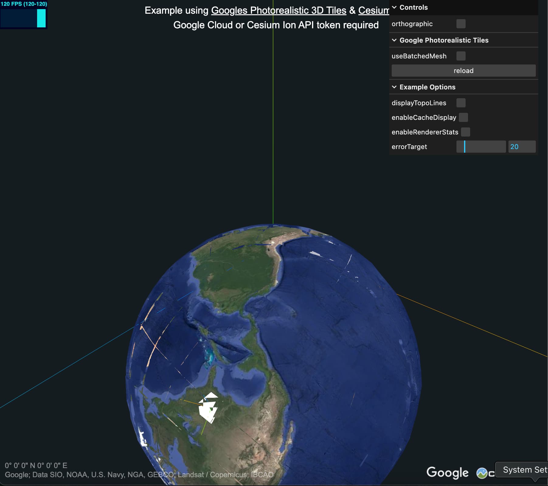

What is the example doing to avoid this z-fighting visible in the screenshot? I replaced the camera and the controls, but i kept the same parameters for the camera. This doesnt seem like it will be an issue since it goes away when i zoom in. Is it just the fact that i moved it off center? (the white lake is now at 0,0,0)
What is the genereal approach to placing objects on the terrain? Like if i want to put an AxesHelper with say Y pointing up, at some exact lat lon, or utm coordinate?
I picked salar de uyuni because i was thinking its super flat, so i know exactly how many meters above sea level it is. Whatever point i chose, is now at 0,0,0, but i have no idea how to map this:
const SALAR_DE_UYUNI_3D_POINT = new Vector3(
	2278314.409660735,
	- 2192828.1316159666,
	5540478.845327073
);
to a lat lon.
Any advice, direction, specs, docs whatever you can point me to would be appreciated.